Digital World Geospatial
With an extensive 35-year legacy in topographical mapping,
DWG is recognized as a premier provider of LiDAR Data and Imagery Acquisition and Processing Services.
We are dedicated to strategically navigating your path to enhanced profitability.
Services we perform
Our steadfast commitment to precision, innovation, and client satisfaction underpins every initiative we undertake. We are dedicated to navigating the pathway to your future profitability.
1. ACQUISITION
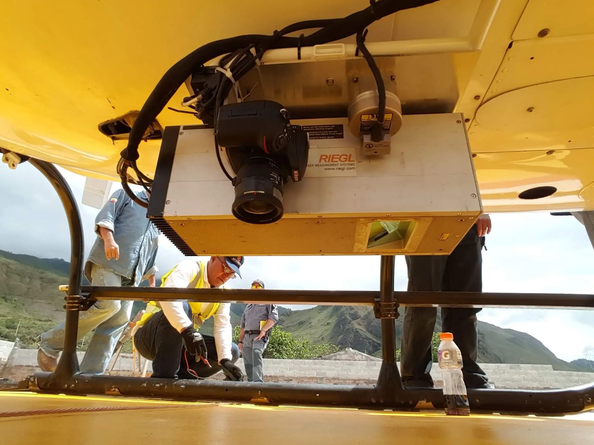
DWG LiDAR services employ advanced airborne sensors to provide accurate 3D elevation data for Digital Terrain Models (DTMs) and Digital Surface Models (DSMs). Our technology captures detailed features, enabling volume and height assessments.
With in-house aircraft and processing, DWG offers tailored solutions for urban planning, mining, and flood analysis, ensuring efficient and precise data collection.
2. PROCESSING
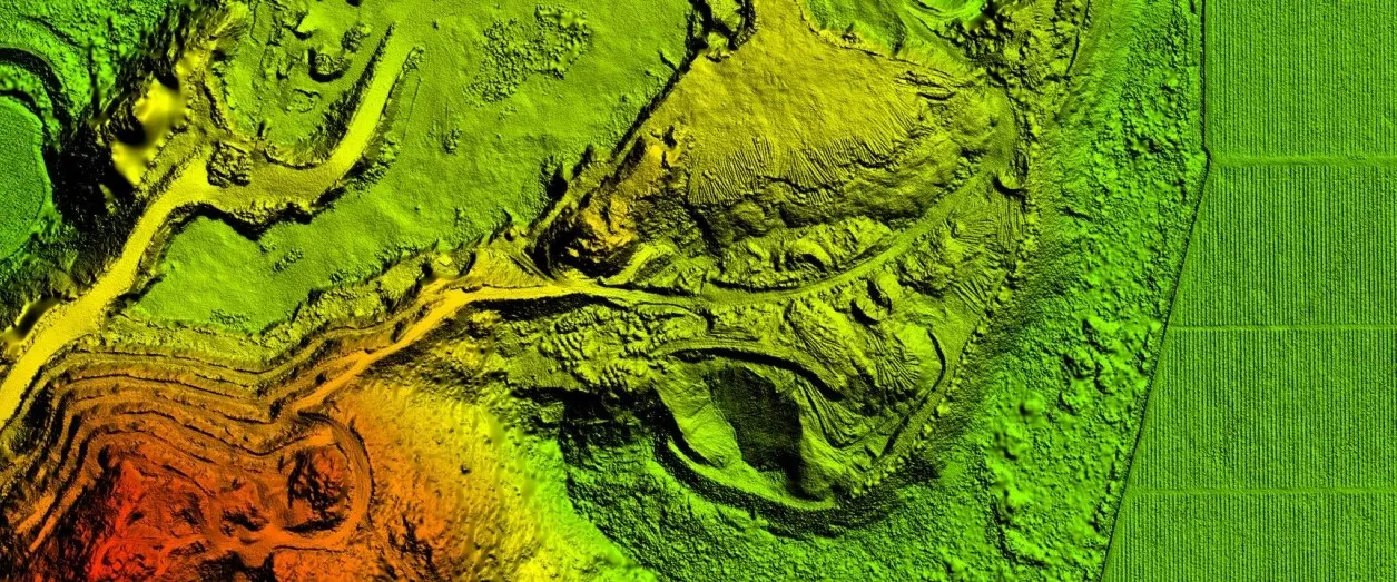
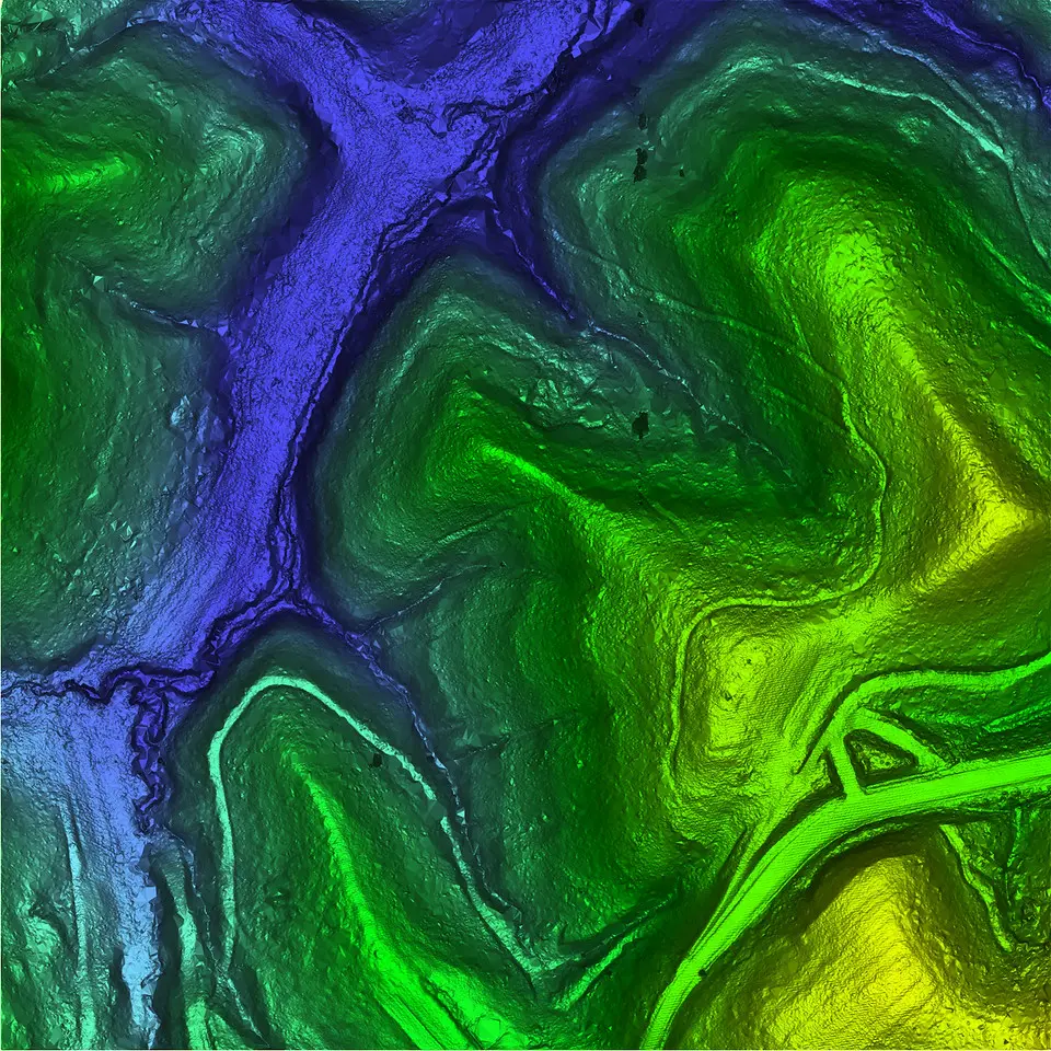
DWG has extensive experience in processing LiDAR data. We excel at combining photogrammetry, imagery, and LiDAR to provide valuable geospatial data for our clients.
Our services include: Classified LiDAR points (LAS, ASCII, etc.), “Bare-Earth” DEMs (ArcGRID, Geotiff), Intensity Imagery (Geo-referenced TIFF, JPG), Ortho imagery or True color LiDAR points (color imagery needed), and customized deliverables tailored to your needs.
3. DELIVERABLES
Once we have completed the meticulous processing of the LiDAR data, we will be well-prepared to generate an extensive and varied array of deliverables. These deliverables will not only include detailed reports and high-resolution visualizations but also a multitude of other outputs tailored to meet specific project needs and objectives, encompassing the following examples and potentially many more that may emerge from our comprehensive analysis and interpretation of the data.
Our story began with a passion for surveying and technology. We started with a small team, bot now we´re a company focused on delivering results and building lasting relationships with our clients.
Our team
Meet our elite team of LIDAR professionals
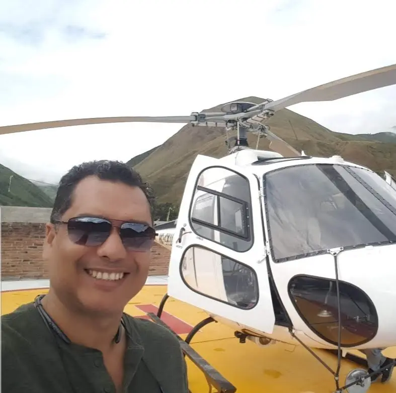
Alberto Moreno
CEO
Mr. Moreno brings 15 years experience to his role in geospatial sensor operations, ground control, flight planning, and logistics in LATAM.

Rodney Cope
CEO
Mr. Cope brings his extensive experience in the geospatial profession to Geospatial Strategic Consultants (GSC).