Services
We offer
1. LiDAR Data Acquisition
We deploy state-of-the-art airborne, mobile, and terrestrial LiDAR systems to capture high-density point clouds with unmatched accuracy. Our advanced sensors collect millions of data points per second, ensuring comprehensive coverage for:
- Aerial Surveys (drones, helicopters, or fixed-wing aircraft)
- Mobile Mapping (vehicle-mounted LiDAR for roads and urban areas)
- Ground-Based Scanning (tripod-mounted for infrastructure or dense vegetation)
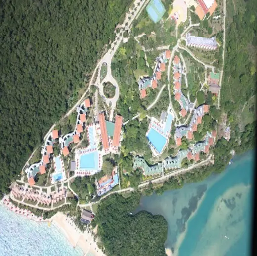
Ideal for: Large-scale terrain mapping, corridor surveys, and hard-to-reach environments.
2. LiDAR Data Processing
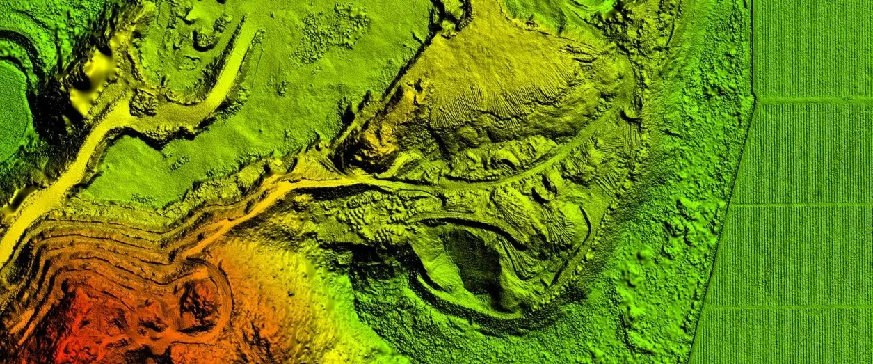
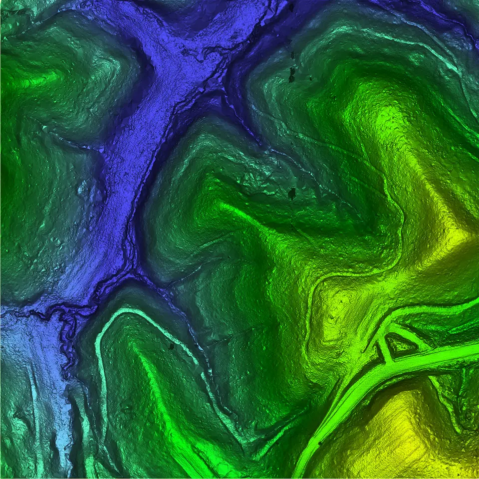
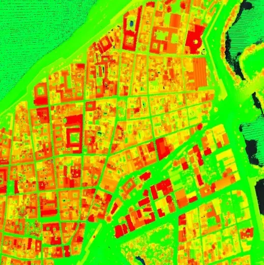
Raw LiDAR data is transformed into actionable insights through AI-powered classification, noise filtering, and georeferencing. Our processing pipeline includes:
- Point Cloud Classification (ground, vegetation, buildings, etc.)
- Digital Elevation Model (DEM/DTM) Generation
- Feature Extraction (roads, utilities, power lines)
- QA/QC Validation to meet industry standards (USGS, ASPRS)
Outputs: Clean, structured data ready for integration with GIS/CAD platforms.
3. LiDAR Deliverables
Turnkey geospatial products tailored to your project needs:
- 3D Models & Contour Maps
- Orthophotos & RGB Point Clouds
- BIM-Ready Files (for construction)
- Custom Reports & Analytics (slope analysis, flood modeling, volumetrics)
Formats: LAS/LAZ, AutoCAD DWG, Shapefiles, GeoJSON, and more.
EQUIPMENT
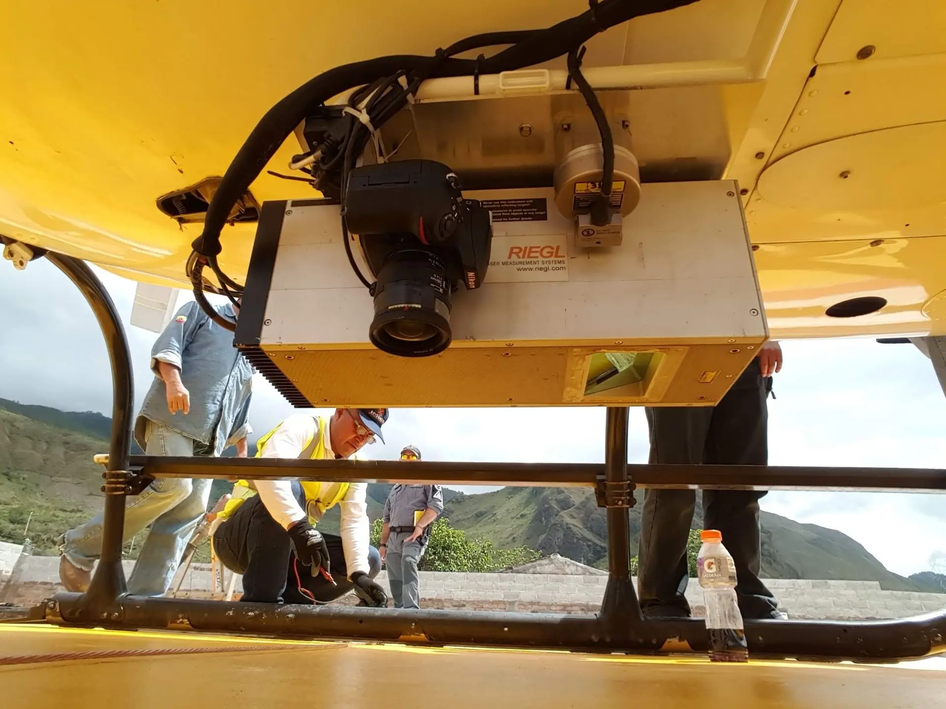
LiDAR SENSORS
Lidar technology efficiently capture high-resolution spatial data for mapping, environmental monitoring, and urban planning over large areas.Double click an icon to replace it with one of your choice.
DRONES
LiDAR with drones enables precise 3D mapping and surveying, capturing detailed terrain data efficiently for various applications like agriculture and construction.Duplicate blocks and columns to add more features.

DIGITAL CAMERAS
Digital cameras for LiDAR capture high-resolution images, enhancing 3D mapping accuracy by providing visual context and detailed surface information.Select and delete blocks to remove features.


More than 40 years of experience, surveying topotamymetric information on 85% of the country's reservoirs, and more than 1,500 successful projects covering more than 12 million hectares with Lidar sensors support the work of AEROESTUDIOS & BATIMETRIA, Colombian companies that have positioned themselves as leaders in the field of Geographic Information Systems (GIS), offering services in aerial photography, LiDAR, radar and thermal sensors, cartography, 360° photography, 3D modeling, cadastre, topography, bathymetry, hydrology, hydraulics, sediments, and property management.
SERVICES
AERIAL PHOTOGRAPHY
Large-format camera mounted on a gyro-stabilized base, which allows for aerial photographs with the same validity as a cartographic plan. We generate true orthophotos, a fundamental input for cadastral updates.
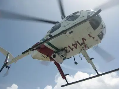
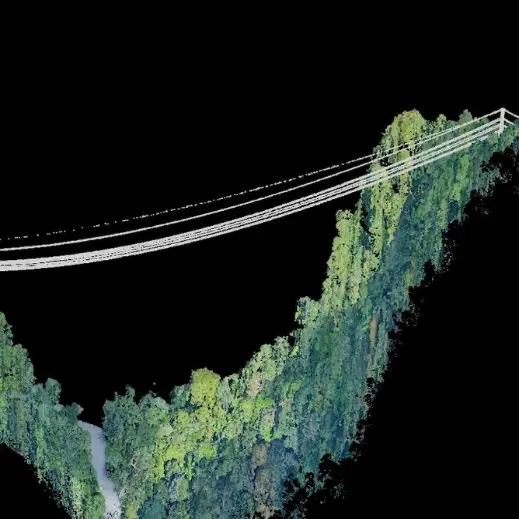
LIDAR SURVEY
We conduct topographic surveys using LiDAR technology carried by piloted aircraft, providing valuable information for engineering projects that require large-scale modeling and design.
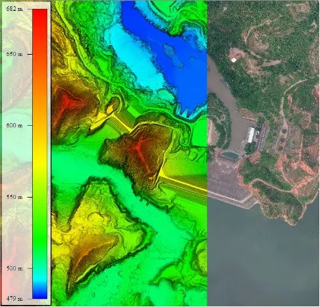
BATHYMETRIC SURVEYS
Bathymetric Surveys
We employ high-precision, state-of-the-art equipment (single-beam and multi-beam) to perform precise bathymetric surveys in reservoirs, rivers, lakes, lagoons, dams, ports, and coastlines.
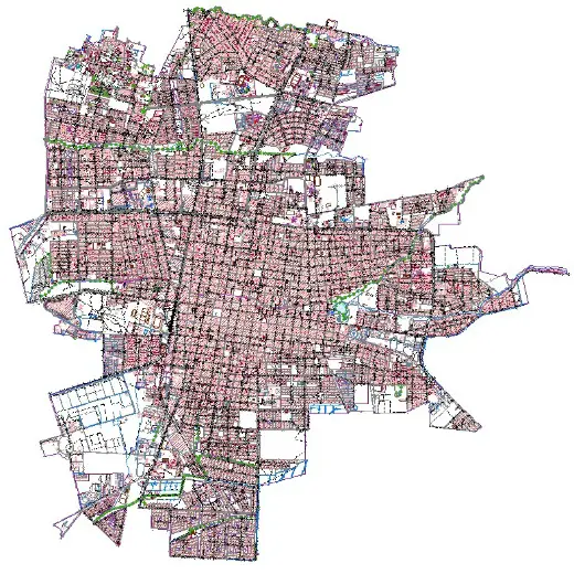
CARTOGRAPHIC DATABASE
We use cutting-edge technology to provide data tailored to each requirement with comprehensive topographic mapping services.
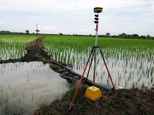
TOPOGRAPHY AND GEODESY
We perform conventional topographic surveys, layout and leveling, volumetric calculations, and land demarcation, including ground control points and geodetic networks for engineering, electrical, mining, and environmental projects.
SUPERVISION
We provide supervision and quality control services for cartographic production projects using various remote sensors for engineering, environmental, and land registry purposes, complying with the guidelines of the IGAC and other entities that receive geographic information.
POINT CLOUD CLASSIFICATION
We classify the three-dimensional point cloud collected by LIDAR sensors into different categories. These categories typically include terrain (ground surface), vegetation (low, medium, high), buildings, bodies of water, and noise (erroneous data).
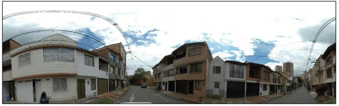
360° IMAGES
We perform 360° imaging or mobile mapping, using instruments capable of acquiring high-resolution photographs of objects located around areas of interest. This camera also georeferences the images obtained, consolidating a route and creating a multipurpose database, the final product of which enables virtual road navigation.
EQUIPMENT
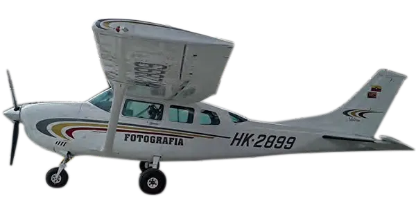
AIRCRAFT
We have a hangar at Medellín's Olaya Herrera Airport, the center of aeronautical operations, and an aeronautical workshop at Bogotá's Guaymaral Airport.Large-format camera mounted on a gyro-stabilized base, which allows for aerial photographs with the same validity as a cartographic plan. We generate true orthophotos, a fundamental input for cadastral updates.
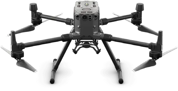
DRONE MATRICE 300
We offer services with unmanned aerial platforms,
all duly registered with the Civil Aeronautics Authority. These tools allow us to provide comprehensive solutions
for a wide range of projects, from the smallest to those of considerable size and complexity. We are committed to providing you with the best solutions.
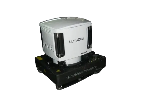
Vexcel Ultracam LP Digital Camera
Phase One iXM-RS150F
Phase One iXM-50 (2 units)
Medium and large format digital metric cameras, mounted on gyro-stabilized bases, along with specialized aircraft navigation equipment. These tools are specifically designed for photogrammetry and digital mapping, providing exceptional accuracy and quality in geospatial data capture.

RIEGL VQ-1560 II-S RIEGL LMS - Q560
Airborne LiDAR sensors for the acquisition of dense point clouds and subsequent generation of digital models.